
There was a lot of documentation available about the town of Ideal and the area in regards to the maps that CF& I kept. They really provide a road map to the town and how it grew over the years.
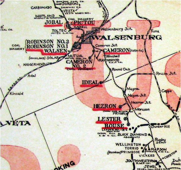 |
The Map to the left shows the area surrounding Walsenburg. It provides you with and idea of how many mines were in the vicinity. Ideal is located about 4.5 miles south of Walsenburg on Ideal Road. |
Information about the Maps:I have been able to gather various maps of the area. Thankfully the Steelworks has preserved the maps that CF&I maintained. These maps provide a nice insight to what the infrastructure of the town of Ideal was like. These maps have helped greatly in identifying what the remaining structures are. In addition it provides insight to the area surrounding the town. The first map of Ideal was created to document the town during the transition the operations from the Ideal Fuel Company to CF&I. Some of the CF&I propaganda was to show how much better life was under CF&I operations versus other operators. The 1911 clearly shows a row of homes and they labeled them as shanties. The map that was updated on a yearly basis from 1910 to 1929 shows just how large the town and mining operations were at Ideal. The Ideal mine actually had three openings and the Ideal, Rouse and Old Rouse mines were connected underground. I suppose that this was done as a matter of safety so that in the event of mine catastrophes the miners would have alternative exits. The map clearly shows that the Rouse and Old Rouse mines as “Worked Out” Today it is very difficult to comprehend the scope of the mining operations, until you really look at the how massive the underground workings of the mines. The last map on this page shows just how large the mines were. |
| Ideal by all accounts was a very slow starter. This map dated 1911 shows 14 numbered houses, and the buildings that were related to the mining operations |
Early Map of Ideal dated 1911 revised 1912 Courtesy of Bessemer Historical Society |
|
|
Courtesy of Bessemer Historical Society |
The map to the left shows the town of Ideal and the mining works , the map was last update in March 1929. | |
| The Map to the right shows the Mining works of the area south of the Ideal Mine. The Ideal Mine and the Rouse mines were connected the area that is in red is the location of the town of Ideal. | 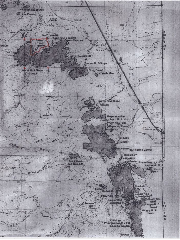 |